Old maps are more than just pieces of paper; they are windows into history. These maps reveal how people once understood geography, culture, and the world around them. Collectors and historians treasure them because each map tells a story. Studying old maps can provide insight into past civilizations, trade routes, and natural landmarks.
Maps from centuries ago were often hand-drawn, reflecting the knowledge and imagination of their time. They show old city layouts, vanished rivers, and forgotten roads. Today, old maps serve as tools for research, education, and even decoration. By exploring these historical artifacts, we connect with a world long gone.
The History and Evolution of Old Maps
Old maps have evolved significantly over time. Early maps were simple sketches made with basic tools, often including mythical creatures or exaggerated landforms. Over centuries, cartography improved, producing highly detailed maps with precise measurements. Each era’s maps reflect technological progress and societal priorities.
The medieval period emphasized religious and symbolic representation rather than geographical accuracy. Renaissance maps introduced scientific approaches, using astronomy and mathematics for better precision. Modern techniques such as triangulation and printing revolutionized map-making, making old maps valuable records of human innovation.
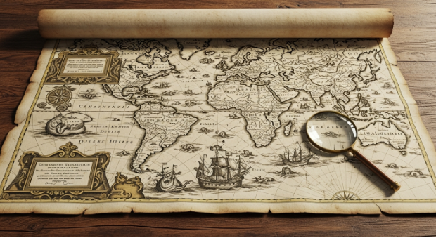
Types of Old Maps and Their Importance
Collectors and researchers recognize several types of old maps, each serving unique purposes. Topographical maps illustrate elevation, terrain, and landmarks. Nautical maps guided sailors with coastal details, currents, and tides. Political maps displayed countries, territories, and boundaries. Each map offers insights into historical contexts.
Old maps also show cultural and economic aspects of society. Trade routes, population centers, and natural resources are often highlighted. By studying these maps, historians understand migration patterns, conflicts, and urban growth. These visual documents offer an unmatched perspective on history.
How to Identify Authentic Old Maps
Authenticating old maps requires attention to detail. Experts examine paper, ink, and printing methods. Watermarks, signatures, and cartographer marks can confirm the map’s origin. Provenance and historical context also help determine authenticity. Buyers and collectors must ensure their maps are genuine to preserve historical value.
Signs of wear, fading, and minor damage often indicate age. However, excessive restoration can reduce historical accuracy. Comparing maps with known originals and consulting experts are essential steps. A well-preserved, authentic map holds both educational and monetary significance.
Collecting Old Maps: Tips and Best Practices
Collecting old maps is a rewarding hobby but requires knowledge and care. Start by focusing on a specific region or era. Research map makers and historical events. Proper storage, such as acid-free frames and controlled humidity, preserves maps for decades. Avoid exposure to direct sunlight to prevent fading.
Budget planning is essential, as rare old maps can be expensive. Networking with collectors and attending auctions can reveal hidden treasures. Maintaining accurate records of purchases ensures provenance and helps build a credible collection. Collecting old maps combines history, art, and investment potential.
Old Maps in Research and Education
Old maps serve as vital research tools. Geographers, historians, and archaeologists use them to track urban development, landscape changes, and historical trade networks. They provide visual evidence that complements written records. Students can explore the evolution of cities and civilizations through these maps.
Using old maps in classrooms makes history tangible. They encourage curiosity and critical thinking by showing real-world changes over time. Digital archives allow broader access to old maps, making historical learning more interactive and accessible. This preserves knowledge for future generations.
Preserving Old Maps for Future Generations
Preservation ensures old maps remain legible and valuable. Temperature control, proper framing, and minimal handling prevent deterioration. Digitization is another effective method, allowing researchers and enthusiasts to study maps without risking damage. Preserved maps maintain historical integrity while reaching global audiences.
Archives and libraries play a crucial role in preservation. Collaborations with museums and educational institutions allow maps to be displayed safely. Communities can engage with local history through exhibitions, connecting people with their heritage. Old maps bridge past and present, enriching our understanding of history.
Conclusion
Old maps are more than decorative items; they are historical treasures that educate, inspire, and connect us with the past. Exploring these maps enriches knowledge and provides a unique perspective on the evolution of our world. Begin your journey today—collect, study, and preserve old maps to keep history alive.
FAQs
- What makes a map an “old map”?
A map is considered old based on its age, historical context, and creation methods. Typically, maps over 100 years old or showing outdated geography qualify as old maps. - Why are old maps valuable?
Old maps hold historical, educational, and artistic value. They reveal past landscapes, borders, and cultures. Rare maps can also have significant monetary worth. - How can I tell if an old map is authentic?
Check paper quality, printing techniques, cartographer marks, and provenance. Consulting experts ensures authenticity and maintains the map’s value. - How should I store old maps safely?
Use acid-free materials, store in controlled temperature and humidity, avoid sunlight, and minimize handling to preserve maps for the long term. - Can old maps be used for research today?
Yes, old maps are valuable research tools for historians, geographers, and students. They provide visual evidence of historical events, city development, and natural landscape changes.